
Mill Creek East Neighbor Sources
A block lookup begins with land records, not a list of people. Snohomish County's parcel map can identify touching lots, and the assessor account can confirm the recorded owner and taxpayer mailing address. A plat explains shared tracts and lot boundaries. Election maps describe precinct geography, but current law and county policy do not turn them into a public list of everyone nearby. Association pages offer public contacts and civic information, not guaranteed resident rosters.
| Block Source | Evidence Around an Address | How to Access It |
|---|---|---|
| SCOPI parcel map | Parcel outlines, situs addresses, owners, appraisal neighborhoods, and recent-sale layers | Free county viewer with parcel clicks |
| Assessor account | Owner, taxpayer mailing address, legal description, values, and account details | Free parcel or address search |
| Subdivision plat | Lot, block, easement, access tract, and shared-interest layout | Auditor recorded-document search |
| Election geography | Precinct and district boundaries, not a complete household list | County maps and personal VoteWA service |
| Community groups | Public meetings, notices, governing documents, and association contacts | Public pages; member areas may require login |
Ownership and occupancy are different. An owner's mailing address can be elsewhere. A renter or family member may have no public parcel record. Use each result only for what its custodian states, then confirm a person through direct, lawful contact or another official record. That distinction prevents a map label from becoming an unsupported claim about who lives behind a door.
Click Through Mill Creek East Neighbors
The Snohomish County Online Property Information viewer, called SCOPI, supports an adjacent-parcel method. Search the known address or parcel ID, zoom until lot lines are clear, and click the target parcel. Its result panel can show Parcel ID, Property Address, and Owner. Additional account details may show the taxpayer, gross acres, market value, tax-code area, and a seven-digit appraisal-neighborhood number.
The captured county interface below shows the source used to map Mill Creek East neighbors. Open the linked SCOPI page first so current layers and notices control.
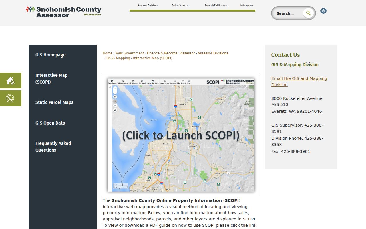
Click each touching polygon and log the parcel ID before recording an owner. The map also offers parcel and house labels, appraisal neighborhoods, recent sales, and aerial imagery. County GIS says its data is illustrative, so a parcel account or recorded plat is needed for formal boundary evidence.
Spot Gaps Between Mill Creek East Neighbors
SCOPI may display “Shared Interest Parcels” or “Not a Legal Tax Parcel” instead of an ordinary parcel number. A shared tract can be a private road, greenbelt, stormwater area, or common space rather than a neighbor's dwelling. Skipping that warning can shift every later click to the wrong lot. Condominiums and multi-parcel sites can also produce several accounts for what appears to be one address.
Match the situs address, parcel number, legal description, and map shape. Situs means the place where the property sits. The taxpayer field can differ from both the situs and the owner's home. If a parcel boundary looks wrong, use the Auditor's plat image and ask the Assessor or GIS office which account represents the physical lot.
Note: Recent-sales layers omit some gifts, estate transfers, quitclaim deeds, and multi-parcel deals, so they are not a complete block history.
Map Mill Creek East Neighbors
Move outward one lot at a time. This keeps the search tied to a visible block instead of all parcels with similar street text. Save only the public facts needed for personal research, and distinguish an owner from a current occupant.
- Normalize the house number, directional, street type, unit, city label, and ZIP before searching SCOPI.
- Confirm the starting parcel's address and ID. Zoom until touching polygons and road names are legible.
- Click each adjacent polygon. Record its parcel ID, situs address, owner, and subdivision.
- Open the assessor account and compare the mailing address without treating it as occupancy proof.
- Check the recorded plat when lots share an easement, access tract, or common parcel.
This method answers who owns the immediate ring of parcels. For a longer run along one named road, use the Mill Creek East street directory, which follows address, parcel, deed, and permit records in sequence.
Read Mill Creek East Neighbor Plats
A plat is a recorded map that divides land into lots, blocks, roads, and shared areas. Neighboring Mill Creek East homes may share the same plat even when postal labels differ. Search the subdivision name with document type PLAT in the Auditor's recorded-document system. Lot-and-block text connects a deed to its mapped position more reliably than a street label alone.
County PDS layers add zoning, critical areas, future land use, and notification geography. Aerial years can show when streets or groups of homes appeared. These layers explain a block's layout, not who occupied it. Mill Creek East grew beside a planned city through multiple annexations, so city permits apply only after the parcel's actual jurisdiction is confirmed.
Mill Creek East Neighbor Voter Myth
VoteWA lets a voter check or update their own registration and ballot status. It is not a public neighbor search. Snohomish County's April 2026 voter-data form says recent legislation prevents the county from releasing voter data and sends requests to the Secretary of State. The county can still provide district maps, including a printed map under its current form.
Even where a lawful voter record is available, it is not a full block roll. Children, unregistered adults, inactive records, and other household members may be absent. Washington's Address Confidentiality Program can also protect voter and marriage records for enrolled people at risk. Ballot choices are never shown. Use election maps to understand districts and direct each person to VoteWA for their own record.
Mill Creek East Neighbor Contacts
Community pages can help a newcomer find public meetings, governing documents, events, and an official contact. They should not be treated as open household directories. The available groups publish different amounts of material, and a name on a board or form does not prove residence at a specific address.
Mill Creek Community Association
The MCCA public page offers community information, forms, and governing-document links, with resident material kept behind its access boundary.
Parkside HOA
The Parkside public site provides governing documents and community information. Homeowner verification is required for private login and forums.
River Crossing HOA
The River Crossing site publishes meetings, contacts, and public community notices without opening a resident roster.
The MCCA capture below shows the public association entry point. Visit the Mill Creek Community Association for its current public material.
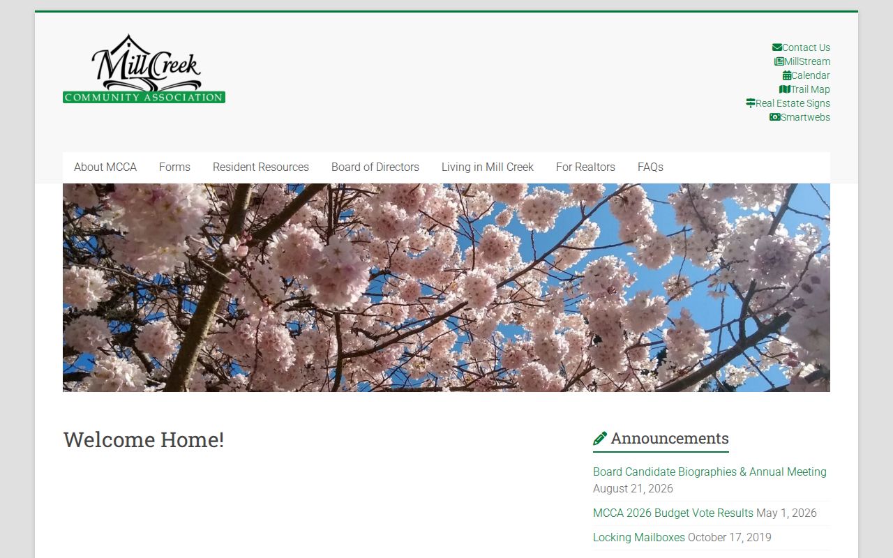
The public-versus-member split is useful evidence of the privacy boundary: community contact is open, while household discussion and verified-owner functions can stay private.
Compare Mill Creek East Neighbor Sources
Official records and commercial neighbor tools answer different questions. The official source identifies its custodian, search field, and limit. A commercial profile may blend licensed data, old public extracts, and user-submitted facts without showing how a match was made.
| Source Type | Best Use | Main Limit |
|---|---|---|
| County parcel and deed records | Recorded ownership, lot, and transaction trail | Does not list every occupant |
| Association public pages | Meetings, notices, and official contacts | Private rosters and forums may require membership |
| Commercial neighbor category | Possible lead for later verification | Data may be stale, merged, or mismatched |
Use a commercial result only as an unverified lead. Return to the county or the organization that created the record before relying on a name or address.
Protect Mill Creek East Neighbors
Parcel records do not disclose every renter, child, relative, or guest. Utility customer lists, delivery data, DMV residence records, and private association rosters are not public block directories. Court files can be sealed or redacted, while juvenile and protected family matters remain restricted. Washington's Address Confidentiality Program supplies an accepted substitute address and can shield enrolled participants' actual voter or marriage record.
A blank result is not proof that a person is absent. It can reflect privacy law, an inactive record, a trust or business owner, a recent move, or a portal delay. Respect closed member areas and never try to bypass identity checks. When public records conflict, ask the named custodian to explain its correction or copy procedure.
Lawful use. Look up neighbors for civic contact, personal safety, or reconnecting. Do not publish a block list or use any result to watch, intimidate, stalk, or harm someone.